Want to know if there’s less snow falling this year compared to past years in British Columbia? Finding out issnow problem at all.
The B.C. government has released a handy tool that allows users to find out how much snow an area has received historically and in near real time.
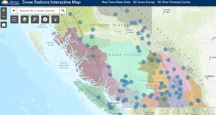
The Snow Stations Interactive Map allows viewers to click on little snowflakes that provide the exact location of a monitoring station, the area’s elevation and links to snow accumulation graphs and downloadable data.
The fun map gives the public access to information collected by the Provincial Snow Survey network and partner organizations.
The government says the snow data is collected and transmitted hourly using the data collection system on geostationary satellites, which are operated by the National Oceanic and Atmospheric Administration.
“The remotely sensed snow and meteorological data from automated snow weather stations is available in near real time, including snow-water equivalent, snow depth, air temperature and precipitation,” the government website states.
“Current-year, near-real-time hourly data for the previous seven days, and graphs of snow-water equivalent from Oct. 1 to the end of the snow season (typically late June), are updated daily.”
You can also search for a snow station by name or ID number on the map.
Find out more information about the Snow Station Interactive Map and snowfall data HERE.
Read the original article here.


