Snowpack levels on the mountains around Powell River have increased over the past two months, but concerns remain whether there will be enough rain to avoid summer water shortages.
Brookfield Renewable Power conducted its annual snowpack assessments for Powell Lake at the end of March and shared the data with the BC ministry of environment (MOE) for its provincial snow survey. Typically, the peak of snow accumulation season in the province happens by the middle of April. According to MOE, the April snow survey data is a good reflection of the overall seasonal snowpack that is available to melt during the spring.
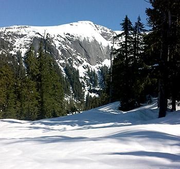
South Coast Mountains, which include mountains around Powell River, have about three quarters of what they normally have on average.
Measurements were taken at two elevations near Lockie’s Table east of the head of Powell Lake. One set of measurements taken at an elevation 1,002 metres above sea level (masl) showed a snow depth of 203 centimetres and the other a little lower at 882 masl had a depth of 145 centimetres.
“Three quarters is still a good number,” said Debbi Stanyer, water resource and environment manager for Brookfield. “What you need to rely on too is the rain.”
Stanyer said the larger point of concern is the amount of rain the area gets this spring. She added that the power company pays close attention to the lake levels and continues to do modelling around water consumption and will adjust how much power is being produced based on lake levels.
On the south coast snow varies from year to year. In April 2010 south Coast Mountains had received 84 per cent of the average but the following year they had 133 per cent of the average.
At the end of January mountains in Powell River’s backcountry had less than 40 per cent of their normal average accumulations. According to MOE, typically mountains by that time should have about half of a whole year’s accumulations. Mountains on Vancouver Island had only nine per cent of the expected average by the end of January but in the last eight weeks have received almost 60 per cent of what is expected.
Wetter weather patterns on the island and south coast were responsible for increases in snowpacks there. The survey shows higher than average snowpacks in the Upper Fraser, Liard, Similkameen and Skagit river basins. Other regions in the province have near normal accumulations.
“The snowpack is pretty healthy for us right now,” said Stanyer, adding that the recent warm weather may already be starting to melt the pack. “We noticed we were getting water in the lake but it was not raining around here.”
During the month of March, Powell River received 123.6 millimetres of rain which is slightly more than the average of 112.7 millimetres. It was also almost a half a degree warmer than usual in Powell River during the month with an average temperature of 5.9° Celsius and 113.7 hours of sunshine recorded.
Environment Canada’s seasonal forecast indicates an increased chance of above normal temperatures for April to June throughout more of the province, with the highest likelihood of above normal temperatures on Vancouver Island and the southwest of BC. However, forecasters do not expect the area to receive an increased chance of rain.
Despite the warming weather, the ministry does not expect there to be an increased risk of flooding in the area as snowpacks begin to melt.
The report indicates that while lower than normal spring runoff can be expected, spring and summer weather conditions will be the key factor in determining whether or not drought will occur.
Climate Prediction Centre at the US National Weather Service is currently forecasting approximately a 50 per cent chance of the emergence of El Niño conditions into the summer. El Niño years typically have increased winter temperatures and decreased winter precipitation and may have an impact on snowpack accumulation for next winter.


