Within a span of five days, residents of the Powell River region were recently reminded of how vulnerable Malaspina Peninsula is to natural disaster.
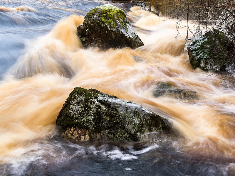
A storm hammered the area from January 19 to January 21, and then again on January 23, with gale force winds of up to 70 kilometres per hour causing multiple BC Ferries cancellations. Heavy rain turned creeks and streams into dangerous torrents and flooded homes in low-lying areas such as Cranberry Lake.
The storm resulted in power outages that lasted more than 12 hours and an earthquake in Alaska alerted some coastal regions to a possible tsunami.
Powell River region does not have an evacuation plan, according City of Powell River councillor Maggie Hathaway, who holds the portfolio for public safety and emergency planning.
“People were asking me during the wildfires last year, ‘How are we going to get everybody out of Powell River if a fire is coming over the hill?’” said Hathaway. “My answer was, ‘I don't know.’ We do need to know.”
The region’s response to immediate, extreme and prolonged incidents, those events occurring separately or concurrently, is constantly being analyzed and assessed by emergency program committees and agencies, including the city, Powell River Regional District, Tla’amin Nation, first responders, BC Hydro, Telus, BC Ferries and provincial and federal government agencies.
“It's being done repeatedly and is always an open book,” said regional district manager of emergency services Ryan Thoms. “Trying to understand more of our hazards and working through evacuation planning, that's the big, exciting one. For us right now it is reviewing and rewriting our evacuation plans.”
To move out of the way of a disaster, residents will use Highway 101, which will absorb traffic from roads that intersect along the 54-kilometre stretch. That’s the plan, if the roads are still there, said Thoms.
“The rule throughout most of the region is one road in and one road out,” said Thoms. “Once you get to the ferry it would be one thing, but in a lot of scenarios, whether they're earthquakes or storms, there is no way out.”
Thoms was recently in New Zealand and visited a community similar to Powell River that had been hit by an earthquake.
“They lost their highways for weeks and weeks before they had a road in and out of their community,” said Thoms.
With no way out or in, the supply chain would be cut off. If goods transported by ferries, barges and air, including food, pharmaceuticals and additional emergency resources and survival essentials, are interrupted, the supplies will not make it to the end of the road.
“We've all seen it,” said Thoms. “When the ferry doesn't run for a few days and the grocery store starts running low on milk, well, guess what? It's not coming.”
Powell River has approximately two to three days of food before a major issue arises and stocks begin depleting and eventually run out, according to Hathaway.
“I'd like to see the grocery stores have a plan in place for how can we distribute what food we have,” said Hathaway, who represents the city on the regional emergency executive committee. Hathaway added that rationing would be necessary.
The communication chain in the region would be taxed in the event of a disaster. Last fall, the emergency communication system crashed during a test after too much information was pushed through the infrastructure, according to Thoms.
“The recent tsunami was really interesting for the warning that came with it,” said Thoms, “because a lot of good things came through when I look at some of the things happening on the west coast.”
A prevailing attitude on the upper Sunshine Coast suggests the region is protected from earthquakes and a major tsunami because of Vancouver Island and the islands of the Salish Sea.
“That’s quite true,” said UBC Faculty of Science professor Michael Bostock. “That does not mean to say a major slumping event or a landslide into the Salish Sea, a local phenomena, might be capable of generating a significant tsunami on the local scale.”
Seismologists understand where a mega-stress event is going to take place off Vancouver Island, but they do not know what crustal faults may be looming beneath the Salish Sea, and to some degree, on land because they are just starting to develop sensing that identifies ancient scarps that might reactivate in the future.
“There may be large structures beneath the Strait of Georgia that we're not aware of that could potentially give rise to local tsunamis that might be significant,” said Bostock. “A major landslide or event that displaces a significant quantity of water in any one of the fjords along the upper Sunshine Coast is going to give rise to a local tsunami.”
People are the known and unknown quantity in many different scenarios of an evacuation plan.
“There's a lot of inherent preparedness that happens in a small community but there's also a tendency to rest on our laurels sometimes because we're a small community and relatively resilient,” said Thoms. “We're used to the odd ferry cancellation and power outage, yet that's nothing like that earthquake or that other big disaster, and not the reality we're used to, of anticipating going out to the car and that the road will be there.”


