Residents in Electoral Area B of Powell River Regional District have an opportunity to help shape future land-use patterns.
A community vision map is one of the new additions to a draft OCP (official community plan) for the area, which stretches from City of Powell River’s boundaries south to Whalen Road and from the coastline north to Powell Lake above Inland Lake and Confederation Lake Protected Area.
Regional district officials have scheduled two open houses to gather the thoughts and opinions of residents, property owners, business people, community leaders and community organizations. The first is being held from 5 to 8 pm on Monday, May 14 at Therapeutic Riding Club in Paradise Exhibition Park, 4356 Myrtle Avenue. The second open house is being held at the same time and location two weeks later, Monday, May 28.
A community plan just for Area B is new, as the area had previously been included, along with Area C, in the southern regional district OCP. After the regional board rescinded second reading of that OCP last year, regional district staff recommended preparing two separate OCPs and directors agreed.
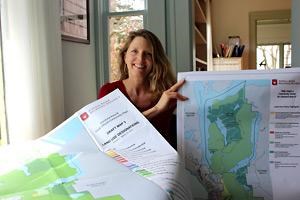
Laura Roddan, regional district planner, was then tasked with preparing the draft Area B OCP.
A community plan is a high-level, visionary document, Roddan explained. In rural areas where there is no zoning, the OCP is often the only document to guide land-use planning in an area, she added. “I think that’s why there has been a tendency to include more specific information that would normally be in a zoning bylaw,” she said. “I think it’s important that people realize what the effect of an OCP is. It’s not regulation, bottom line. It is visionary and once it’s adopted and in place, then decisions have to be in synch with it. It’s supposed to be looking to the future.”
Roddan hopes residents will provide feedback on the vision map, which will guide land-use decisions, including applications for subdivisions and Crown land referrals, in the future. “We’re hoping we can get support for adopting a community vision map,” she said.
The vision map is a new perspective for Area B, Roddan said, but not provincially or nationally. “Across Canada, OCPs should include a future land-use designations map,” she said. “It’s actually something that’s been missing in the previous plans.”
To develop the draft vision map, Roddan used a number of sources, including the work that had gone into the draft OCP for the southern region and information gathered by Powell River Community Foundation in preparing its Vital Signs report. “Things really lined up,” she said. “There was real consensus on the need to protect the natural environment and rural lifestyle.”
Providing for regionally sustainable agriculture was another theme, Roddan said. “There is a lot of agricultural reserve land within Area B and it’s some of the most productive agricultural land in the Powell River Regional District,” she said.
The open houses will be different, Roddan said, and she hopes Area B residents will come out to both. The first open house is going to focus on the vision and land-use maps. She wants to make sure that existing uses are recognized on the land-use map. As well, she wants to build support and understanding of the vision map, as well as key policy directions. “Everything is going to be interactive, so we’ll be collecting people’s ideas,” she said. “When we come back to the second open house, we’ll actually have the revised final plan and maps. We’ll be making a presentation about the final map and doing a double-check that we’ve incorporated people’s concerns.”
The draft Area B OCP can be viewed on the regional district website at www.powellriverrd.bc.ca or at the regional district office, 5776 Marine Avenue.
For more information, interested readers can contact Roddan by phone 604.483.3231 or email [email protected].


