Eyes in the sky are becoming an increasingly important tool for boots on the ground when it comes to fighting wildfires, experts say, as data from a growing number of satellites give firefighters new tools to predict fire behaviour and analyze its consequences.
"It's being more and more adopted," said wildfire expert Mike Flannigan of Thompson Rivers University.
"In the old days, almost no one was using satellites. Now they're being used more and more."
The last decade has seen a huge jump in the number Earth observation satellites, driven by cheaper technology and the entry of private industry.
A count from the Union of Concerned Scientists says there were 192 such satellites in 2014. Now there are 971.
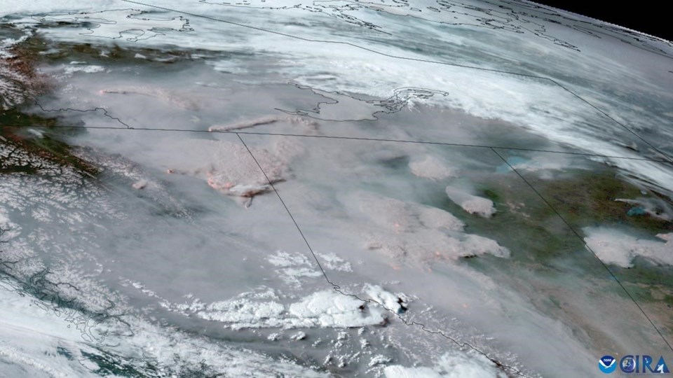
That has given wildfire managers and scientists unprecedented ability to get the big picture, said Joshua Johnston, a Natural Resources Canada scientist working on WildfireSat, which will be the world's first purpose-built satellite for monitoring wildfires.
"Putting eyes on a fire is the most valuable intelligence you can get," he said. "There's not enough pilots to fly every fire in the country on a daily basis, let alone twice a day."
One of the most useful readings from satellites is called fire radiative power, a measure of how much energy a fire is emitting. That tells fire managers where the hot spots are, where it's most likely to advance and how quickly.
Knowing how hot a section of the fire is can also suggest how best to fight it, Flannigan said.
"You can tell if dropping water or fire retardant on that part of the fire would work or if you'd be wasting your time."
What's more, knowing how hot the fire is burning allows scientists to calculate what it is putting into the atmosphere. Forecasters use the European Space Agency's Sentinel satellites to figure out a vast range of emissions, from greenhouse gases to particulates to carbon monoxide.
"It's an estimate based on radiative power," said Mark Parrington of the European Centre for Medium-Range Weather Forecasts in Bonn, Germany. "There are various conversion factors which say for this type of vegetation, this is the amount of carbon and particulate matter you expect."
Parrington said the European satellites also make it possible to track smoke as it moves around the globe. As of Friday, smoke from the fires in Alberta and British Columbia was traceable as far as the west coast of Europe.
Still, there are relatively few satellites that fly over northern latitudes such as Canada's. Those that do fly over at times when fires aren't burning at their peak.
WildfireSat, scheduled for launch in 2029, will fix that, Johnston said.
"There's a short of satellites that we can actually use," he said.
WildfireSat is to fly over Canada in the late afternoon. That's when fire activity is at its peak, and give firefighters even better ability to predict behaviour and chances of success.
Improvements in satellite technology are also getting crucial information into the hands of firefighters more quickly.
"It's very time-sensitive," said Flannigan. "If it's yesterday's data, (firefighters) don't care."
During the 2016 fire that scorched much of Fort McMurray, Alta., satellite data was downloaded in Ottawa and shipped to Edmonton, by which time it was too old to be useful. That doesn't happen anymore, Flannigan said.
"It's there in real time."
The ashy boots of a firefighter slogging through smoky muskeg are never going to be replaced in battles against wildfires that climate change is worsening. But while that firefighter may feel as far from the vastness of space as it's possible to get, the links are there and getting stronger all the time.
"There are lots of satellites up there and a lot of them have sensors useful for fires," Flannigan said.
This report by The Canadian Press was first published May 21, 2023.
Bob Weber, The Canadian Press


