The public comment period is open for the first phase in drafting the shíshálh-B.C. Land Use Plan.
An online questionnaire and details of the joint land use plan can be accessed at landuseplanning.gov.bc.ca. The closing date for comments is Jan. 31.
The purpose of the public feedback is to “help the shíshálh-B.C. Land Use Planning Table understand early interests, opportunities, and concerns as they relate to the land use planning process and its initial planning themes,” according to the planning table, a technical group made up of two representatives each from the province and shíshálh Nation.
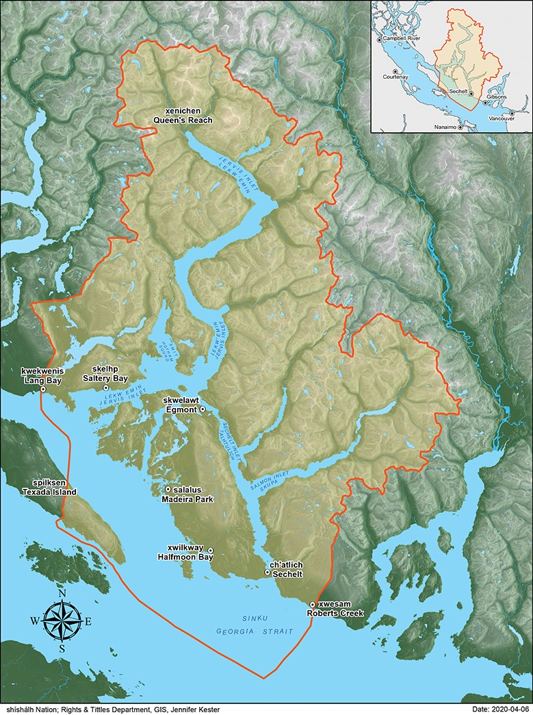
The plan area will encompass the traditional shíshálh Nation swiya – or territory – but will not apply to shíshálh Band Lands, shíshálh fee simple lands, federal lands, and private lands.
Asked to specify exactly what lands are covered under the plan, Jeff Juthans, a provincial land and resource specialist who co-chairs the planning table, said in an emailed statement: “The joint land use plan can pertain to those lands or waters in the swiya currently under both shíshálh and B.C.’s jurisdiction for sustainable land and resource stewardship.”
The plan “will set the strategic direction to guide sustainable resource stewardship and management of lands and waters in the swiya to meet economic, environmental, social, and cultural objectives at a broad scale,” Juthans added.
“Strategic level management direction affecting old forests, forest biodiversity, watershed integrity, shíshálh cultural resources, and sustainable economic development is the focus of the land use plan.”
The plan could also propose new protected areas “along with some other legal conservation designations and objectives,” and “could also provide some additional information for consideration in the future management of any existing provincial parks/protected areas.”
However, in a follow-up interview, Juthans said there is no intention of opening up provincial park management plans. “The existing parks are there,” he said.
A backgrounder describes the swiya as extending “from xwésám (Roberts Creek) in the southeast to the height of land located north of xénichen (head of Queen’s Reach) in the north, kwékwenis (Lang Bay) to the west and spílksen (Texada Island) to the south.”
Early engagement
The comment period opened Dec. 11 and Juthans said some early initial engagement sessions have taken place with local governments, Tla’amin First Nation, forest licensees and aggregate licensees.
The results of the questionnaire and initial stakeholder workshops will be summarized in a “What We Heard Report” that will be made available on the project website later this spring.
The land use planning process will be carried out in four phases, with a draft plan expected to be completed in 2023. Public and stakeholder input will also be part of future phases.
The planning table was developed as part of the Foundation Agreement signed by the B.C. government and shíshálh Nation in October 2018.


