More than half of Canadians say climate change is impacting where they decide to purchase a home, according to a new poll.
The survey, conducted by Leger, was part of a wider RE/MAX Canada report released Tuesday (July 5) looking into how the housing market will respond to different shocks from climate change — including floods, wildfire and severe storm events.
Over the next five years, 57 per cent of Canadians said potential weather-related events are a key factor in where they choose to buy a home. The Leger survey also found just under half of the respondents were worried about the impact flooding, forest fires and other weather-related events will have on their homes or neighbourhoods in the coming years.
Still, 61 per cent of respondents believe buying a home is the best long-term investment they can make between now and 2027.
To safeguard those homes, the report concluded that Canada needs to ramp up its investment in green, grey and brown infrastructure to the tune of billions of dollars annually.
"We have been depleting and destroying our natural infrastructure for decades in the interest of urban development," says Kathryn Bakos, the Intact Centre on Climate Adaptation's director of climate finance and science, in the report.
"…we must now reverse and correct that damage to ironically protect much of what we've built."
Restoring Canada's wetlands and marshes, its forested areas and grasslands, and modernizing the country's sewage systems, will all require an immediate injection of $5.3 billion a year, said Mike Moffatt, senior director of policy and innovation at the Smart Prosperity Institute, which also co-authored the report.
But wait too long, and the coming decades of temperature extremes and flooding would hike the yearly bill by billions of dollars.
Of Canada's total infrastructure value, almost 85 per cent is found in privately owned homes, according to Statistics Canada.
Flooding Canada's costliest climate-driven disaster
Between six and 10 per cent of Canadian homes are already uninsurable for flood risk, notes the report. And as Canadians continue to build on floodplains, that number will only grow, said Bakos.
Both Bakos and Moffatt say public and private investment needs to focus on the buffering effects of natural defences — patches of green that clean water, reduce peak flooding and extreme temperatures, and provide a number of other cascading benefits to people and the ecosystems that surround them.
Drawing on data from the Insurance Bureau of Canada, the report says the overall costs of insured catastrophic loss climbed to $2.5 billion in 2021 from $1 billion in 2005.
When it comes to climate-driven impacts on housing, floods are now the costliest weather-related disaster in Canada, leading to average repairs of about $40,000.
Selling a home is inevitably more difficult too. According to one study from the Intact Centre, between 2009 and 2020, Canadian communities hit by catastrophic floods suffered significant market fallout over the following six months, including an 8.2 per cent reduction in the average sold prices of homes and a 44.3 per cent decrease in listings. Homes in these communities also spent 19.8 per cent more time on the market than in other communities.
That makes sewer upgrades — such as separating stormwater and sewage into two pipes to prevent overflow — especially important. Prevent the disaster in the first place and save individuals thousands of dollars in the long run, the thinking goes.
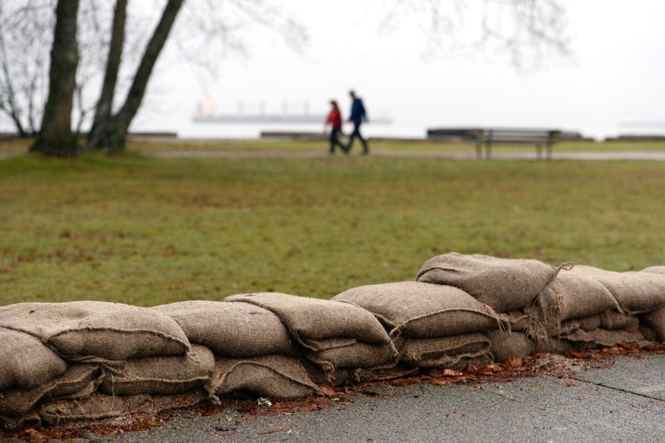
In B.C., upgrading dikes not enough
The latest RE/MAX report also pointed to upgrading infrastructure to guard against coastal flooding, especially in British Columbia, where 96 per cent of dikes in the area are assessed as too low.
"Although it is important to maintain these, it should not be the only measure taken. Managing vulnerable areas via land use planning and moving individuals out of high-risk areas is more effective in the long-term," said the report.
The Canadian federal government is developing its first National Adaptation Strategy, a blueprint for society to weather the fallout from climate change. It's expected to be released later this year.
Part of that plan, says Moffat in the report, needs to include a government "safety net" for homeowners who don't qualify for insurance but live in chronic flood zones. That could take the form of government-supported premiums (in line with a federal task force currently examining the viability of a low-cost national flood insurance program) or buybacks of residential property to convert floodplains to their natural state.
Disclosing the actual flood risk for hundreds of thousands of Canadian homes will inevitably impact their value. That's because national flood risk maps — which Canada is currently updating and are used to underwrite insurance, inform home buyers and help plan new infrastructure — are 20 to 25 years out of date, according to the Insurance Bureau of Canada.
That means at least half a million buildings at risk of flooding are not identified on current government flood maps, and "virtually none of them show how climate change may affect the future risk of flooding," found a landmark study released last year by the Canadian Institute for Climate Choices (CICC)
One 2016 survey from the IBC showed that roughly 45 per cent of Canadian homeowners have insurance that will pay for flood damage, when in fact, only 10 to 15 per cent are covered.
That risk is not shared equally across the country.
Flood insurance premiums projected to soar 7-fold without new federal help
In B.C., the number of homes at risk of storm surge is projected to climb 44 per cent by the end of the century to nearly 70,000. That's more than any other province in the country. And in Metro Vancouver, roughly $30 billion in home and building value sits within one metre of current sea level. Many municipalities in the region also face twin pressures from rising seas and a network of massive rivers.
Between 2070 and 2100, Metro Vancouver's annual flood damages are expected to climb up to $820 million annually, 27 times the current value, under a high-emissions scenario.
That's all expected to filter down to individual homeowners. Fifty years from now, average individual property damage is projected to hit $4,400 per year in Metro Vancouver, more than seven times today's cost, found the 2021 study.
"In hot real estate markets such as Vancouver and Toronto, this means that property buyers — from individual homeowners to commercial real estate investors — are likely paying too much for homes and buildings whose value will drop when their flood risk becomes apparent," warns last year's CICC report.
But flood maps could also offer an opportunity, RE/MAX Canada's executive vice president Elton Ash said in the real estate firm's latest report.
"In principle," said Ash, adding climate risk to the list of what a homeowner must disclose is "very logical."
"It would help residents across Canada identify areas and neighbourhoods of resilience, which could drive additional investment, stronger liveability, lower insurance premiums and a more resilient housing market in those regions."
He also added a warning: For it to work, the information must keep up with a changing climate.
Investments meant to help people and infrastructure adapt and weather climate change "need to be advancing in lockstep."
RE/MAX Canada's first five-year housing report, released in May, looked at how the country's housing market might respond to different economic scenarios, such as interest rate hikes, annual immigration and taxation.


