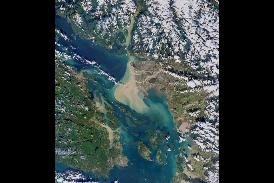
The effects of B.C.’s devastating floods were recently captured in a single image taken by a NASA satellite.
Chris Hadfield, one of Canada’s most well-known astronauts shared the photo on social media the same day B.C. announced the province was in a state of emergency. The photo showed the mouth of the Fraser River spewing out much more silt into the Strait of Georgia than seen in previous years around the same time.
“Amazing movement of topsoil into the sea. Stay safe, all,” the former commander of the International Space Station wrote on Twitter.
It’s not only silt and topsoil moving into the strait though; Transport Canada has warned of large amounts of debris and high water levels posing a hazard to vessels and shoreline properties.


