With the intention of resolving conflicts and generating tourism, the Outdoor Recreation Users Group’s ad hoc committee is busy working toward designating trails and increasing education and awareness.
The committee, made up of multiple groups and organizations, intends to serve a number of purposes. On the one hand it serves as a way for different groups to communicate and work together on solutions for potential conflicts. Also, the groups work together on projects that benefit them all, rather than each trying to do everything on their own.
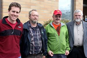
The ad hoc committee has representatives from the Powell River Trail Riders, Powell River ATV Club, Powell River Parks and Wilderness Society (PR PAWS), the BOMB (Bloody Old Men’s Brigade) Squad, Knuckleheads Winter Recreation Association, Powell River Cycling Association, Back Country Horsemen of BC and Powell River Community Forest Ltd. The Powell River Regional District and the City of Powell River are also involved, along with Frank Ullmann from the ministry of forests, lands and natural resource operations.
Some of the problems and conflict areas that the group deals with are common and ongoing. Part of the idea of designating trails for certain users is to prevent the frustrations that come from run-ins with different users on the same trails. Different users need different types of trails and often one can ruin a trail for the other. Motorized vehicles, for instance, rip up trails and make them less ideal for mountain bikers and hikers.
“We can agree on probably 95 per cent of trail uses,” said committee member and Powell River Cycling Club president Russell Brewer. “And the other ones, where there’s some potential conflict, we work on resolving it, trying to educate our respective members.”
The group is working toward officially designating trails as single, dual and multi-use. It is hoped this will resolve conflicts over rights to use and help keep trails in better condition for their designated activities. By having the trails named, designated and located by GPS coordinates they will be easier to find and more inviting to tourists and locals alike.
One of the most popular requests heard from tourists visiting Powell River is for a map of the area that shows all the trails. The committee is creating a map, that will be available online and hard copy, of all the trails in the region and what they are designated for. The first draft is expected to be completed this month, with the final map available to the public later this year.
Having the map available and signs on trails announcing designations, along with educating the public, will work toward what the group considers to be the best tool in combating conflict: education. Conflicts still arise, such as at the Vancouver Island Mountain Bike Race where some horse riders had an issue with some dirt bikers who initially ignored calls to shut off their motors for the horses to pass.
“It’s about respect and accountability. Those are the two words that we emphasize,” said Dave Hodgins, president of the Powell River ATV Club. “That’s the message that we have to get out.”


