Early railway surveys resulted in the first detailed mapping of southern British Columbia, revealing a limited number of potential pass and route combinations through the Coast Mountains.
One of the earliest efforts, however, belongs not to the Canadian Pacific Railway (CPR) as one might expect, but to the Pacific Great Eastern Railway. It was 1870 when the Stanley Smith expedition was commissioned to survey and map a passage from the head of Lillooet River through Ring Pass to the coast, via Bishop River and winding up at the head of Toba Inlet. This was unexplored territory. The party had no idea what to expect. Months later, when the expedition failed to report back, it was surmised that the explorers met their ultimate doom in the vast and treacherous Lillooet icefields. No member of the Smith expedition was seen or heard from again.
A later expedition was charged with tracing their original route to try and find out what happened, but to date no evidence has been found. Glaciers in the Lillooet icefield were named in honour of Smith and his brother who had joined him on the journey.
After the failed Smith expedition, the Pacific Great Eastern tried again to push a route through via Bute Inlet, but it eventually settled for a railroad that would run from Lillooet through Squamish to Howe Sound. What it achieved was a result far shy of its initial intent.
The Howe Sound and Northern Railway at some point had constructed nine miles of track north of Squamish. This spar would allow transport of resource and mining material south to the harbour at Horseshoe Bay. By the time the BC government stepped in there were two separate stretches of track—a 20-mile stretch between north Vancouver and Horseshoe Bay, and another between Squamish and Clinton. The government proceeded to extend the track to a point just north of Quesnel.
Waddington's Road and the Chilcotin War of 1864
At the height of the Cariboo gold rush, Alfred Waddington saw the need for a shorter, more passable route to the goldfields rather than having to traverse the treacherous Fraser Canyon and/or Douglas Roads. As with the tension between railroads to find the first passable route, Waddington was neck and neck with the Cariboo Wagon Road project.
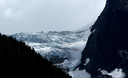
Waddington obtained a licence from the colonial government to build a road from the head of Bute Inlet via the Homathko River (approximately 120 kilometres from Powell River) through rocky unforgiving terrain to the Chilcotin Plateau. With access to Bute in place, the plan was to have steam ships from Victoria bring travellers to the head of Bute, who would then take a toll road east to Fraser River and then continue on to the Cariboo.
When at last Waddington set out on his grand plan to build his road, beginning at the Homathko River, all was running smoothly until Tsilhqot'in warriors—Northern Athabaskan First Nation—who had taken work with his crew to stave off famine in their homeland, became unsettled and chose to oppose him. For a time the situation was tense and Waddington predicted that things could get out of hand if left unchecked. To deal with the predicament, one of Waddington’s foremen employed a practice that was initially established by priests and missionaries attempting to impose Christianity on “untamed” villages. One simply had to threaten to inflict disease upon the potential aggressors to achieve the desired result. Word had long since spread from the coastal first nations that Europeans indeed possessed the ability to wipe out entire villages simply by willing it. First nations people had seen their own shamans use the same magic many times on a professed enemy, so believed it to be true.
Waddington’s foreman threatened smallpox on the warriors and their people. It was a grave mistake. The Tsilhqot'in, led by a respected Xeni Gwet'in warrior called Klatsassin, took revenge and attacked Waddington's crew. All but three men were killed. Those three escaped and made their way to civilization. Once word got out what had occurred, a gang of volunteers from the Cariboo region, led by a regiment of troops from Victoria, set out to interpret and exact some measure of justice. The Chilcotin War of 1864 drew to an end when Klatsassin surrendered on the promise of amnesty. Once he was in custody, his captors betrayed the terms of his surrender and he was sentenced to death and hung near Quesnel.
Proposed Canadian Pacific Railway route
From a Canadian Pacific Survey, published in 1877, written by Sandford Fleming, the Bute Inlet route was a serious consideration for the mainline of the Canadian Pacific Railway (CPR). However, this would have seen extensive blasting down the west shore of the inlet and a complex series of bridges erected to reach Vancouver Island near Campbell River at Seymour Narrows.
The Chilcotin War damaged relations between first nations and westerners in the area. Steep, rocky mountain passes, deep river valleys stuffed with dense forest, and intense grades that would have to be overcome to reach the Chilcotin Plateau once the eastern face of the coast range was breached, were all major strikes against the route. The route, if taken, promised to be a large investment to develop.
Meanwhile, Fleming was under strict orders from the CPR to make a decision on a passable route forthwith. His orders, quoted from a report on the CPR published in 1877, advised: “It is of the utmost importance that the government should be placed in possession of certain information at the earliest possible moment so that a judgement may be formed respecting the several proposed routes to the Pacific coast."
The CPR surveyors journeyed up Bute and quickly concluded that no railroad could be built economically there at that time. The Bute, Toba and, later on, just prior to WWI, the Sunshine Coast-Squamish route, were all passed over in favour of the Yellow Head Pass / Fraser Canyon route. The canyon route supplied quick access to the bustling new port-city at Burrard Inlet—the City of Port Moody.
Today, those opposed to the notion of punching a road through to Squamish cite the harsh reality of the remote mountainous region that would need to be transversed. In a viewpoint published in the Peak July 2013, Peter Behr, a 40-year resident of Powell River who spends much of his leisure time hiking and snowshoeing in the backcountry, wrote that there are serious drawbacks to the initiative.
The reality, he wrote, is that instead of a leisurely two-hour drive, there would be a winding two-lane, summer-only mountain road like Duffy Lake Road.
“There is a huge amount of snow in the inland mountains and valleys,” Behr wrote. “The highway would need regular snow and ice removal eight months a year. The cost would be astronomical.”
Others opposed to the idea assert that it would be a wasted investment, dollars that would be better spent looking at other transportation alternatives or other ways to bolster economic foundation in Powell River.
The CPR surveyors who journeyed up Bute quickly concluded that no railroad could be built economically at that time. All possible mid-province routes were passed over in favour of the canyon passage to Burrard Inlet, a route that supplied quick access to Port Moody.
It was decided then that relatively isolated, water-bound cities on the mainland would hence-forth be served largely by ocean transport.
In the end, by virtue of the resources and technology that was available at the time, it was the steep, rugged coastal BC terrain that dictated which part of the province would prosper from what would become high volume, convenient access.
The debate today centres on whether or not the route is economically viable. New technology, the need for economic growth in isolated areas and the prospect of an economic corridor extending from Vancouver Island through to the BC interior goes head to head with the cautious balanced skepticism based on the reality of the same tough country that beat the men who tried to break through a century before.
Next week, in the last of a three-part series on the Third Crossing, the Peak takes a look at both sides of the debate and asks the ultimate question: where do we go from here?


